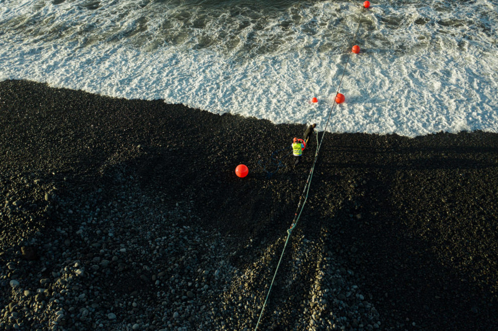
In May 2022, the Portuguese Foundation for Science and Technology (FCT) and EMACOM – Madeira Telecommunications signed a protocol to promote the use of optical fibre for research purposes – the first step towards the creation of the GeoLab. Six months later, Orlando Frazão, INESC TEC‘s researcher, coordinated the first research project to use the EllaLink GeoLab – an infrastructure created from the EllaLink submarine cable to study the conditions of the ocean floor.

EllaLink GeoLab is supported by a third fibre installed in the derivation to Madeira, owned by EMACOM, which also provides the services for hosting the measuring equipment with DAS technology at the Amparo mooring station.
The management and operation of the EllaLink GeoLab experiments is the responsibility of FCT, through the FCCN Unit, which ensures the access of the research and education community to these resources, acting as “a glue that guarantees the communication between all the participating entities and companies”, as referred by Clayton Costa, from the FCCN Unit. Clayton Costa also highlights the strategic importance of the GeoLab project as an important advance for Portugal, by enabling “regions that are not located in the mainland to be the stage for new projects”.
We invited the INESC TEC researcher, Orlando Frazão, to explain how these resources have contributed to the scientific work, namely the role that the GeoLab technology can play in the protection of the oceans.
How are the GeoLab resources important for the research you have been developing?
Over the past few years, INESC TEC has developed and worked on projects in the area of distributed measurement, both in laboratory environments and in real situations. The close collaboration with the University of Alcalá has allowed obtaining knowledge about the DAS [Distributed Acoustic Sensor] technology.
The need to seek partners that can use this technology is one of the goals of the Center for Applied Photonics. The collaboration with EllaLink GeoLab will allow the application of DAS technology in a real application, namely by taking advantage of the installation of the submarine cables and their connection with the DAS equipment to study various phenomena of nature and human activities.
The main objective of this research project is monitoring submarine cables located in Madeira using DAS technology. It also aims to analyse and compare the results obtained with DAS installed in various parts of the world.
What results have been obtained from the GeoLab and how is this knowledge relevant to the ongoing research?
At the moment, the equipment is in data acquisition mode. Considering the large amount of data to be stored, its analysis is complex and will take several months to complete. However, the knowledge acquired will be very relevant for understanding the movement of tides, boats, and the detection of microseisms.
How do you evaluate the process of articulation with the infrastructure? Are all expectations being met?
The process of articulation with the infrastructure was complex, but the collaboration between the two partners has been excellent and we hope that the system in operation will present fruitful results by the end of the project.
What do you think is the relevance of GeoLab, within the national scientific system?
I think that Portugal has a very important maritime coast, which is nothing less than a living laboratory full of potential for the development of scientific activities. It is also of high importance to protect our coast, a process that ideally should be done 24 hours a day and in real time. DAS technology enables such monitoring, and we hope to demonstrate this achievement by the end of the project. The future is at sea, and I think we should make use of our scientific community for national and international scientific enrichment.
Find out more about EllaLink GeoLab at https://ella.link/geolab

Read or download the full magazine here


